Best Hiking Trails in China (2026): A Difficulty-Graded Guide, and the Legendary Routes Now Closed
English-language hiking guides still sell China as a place of “hidden trails and untouched peaks.” The reality in 2026 is more useful: China has world-class hiking, a handful of crowd-free classics, and several famous routes that are now legally closed to visitors. The closed ones are the ones you have probably read about (the Everest East Face, the Langta traverse, parts of the wild Great Wall), so if you are planning a trip from an older blog post, you need to know what changed before you book anything.
This guide grades the trails that are open and worth your time, tells you exactly what permits, altitude and equipment each one needs, and deals plainly with the routes that are off-limits. If you want a route that a fit traveller can actually walk this year, read the first half. If you want to understand why so much China “trekking” content online is out of date, read the last half.
How we verified this: SinoWander reads the Chinese sources English guides cannot. This page was built from Baidu Baike (百度百科) entries for each mountain and trail, including Tiger Leaping Gorge, Yubeng, Gongga, Huashan, Wugongshan and Yading, cross-checked against Mafengwo (马蜂窝) trekking guides and, for every permit and closure question, against the official legal framework: the Regulations on the Protection of the Great Wall (长城保护条例), the Administrative Measures on Mountaineering by Foreigners in China (外国人来华登山管理办法), and national entry-exit and border-zone rules. Closure information is as verified on 2026-10-15 and changes quickly, so always confirm with official channels before travelling. See our methodology.
How to Read This Guide: A Three-Grade Map
China’s hiking splits into three practical tiers. Everything in this guide fits into one of them, and the tier decides what gear, fitness and paperwork you need.
| Grade | What it means | The trails | Key demand |
|---|---|---|---|
| Medium classics | 1–4 days, well-trodden, no permit, altitude under ~3,300 m | Tiger Leaping Gorge, Yubeng | Fitness, not expedition skills |
| High-altitude commitments | 5–8 days, 3,500–5,000 m, permits and guides usually required | Gongga, Motuo | Altitude acclimatisation + paperwork |
| Single-day scenic hikes | 4–8 hours, cable cars or clear paths, often inside scenic areas | Huashan, Wugongshan, Yading, Huangshan, Zhangjiajie | Legs and early mornings |
A fourth tier exists, the extreme multi-day wilderness traverses, but in 2026 two of its best-known names, the Everest East Face and the Langta traverse, are officially closed to trekking. We explain that in a dedicated section rather than recommending them.
The Medium Classics: Crowd-Free Hiking That Actually Works
If you want to hike in China without altitude sickness, expedition gear or a permit application, start here. These two are the best open multi-day routes in the country, and both are well-served by local infrastructure.
1. Tiger Leaping Gorge High Trail, Yunnan — the international favourite
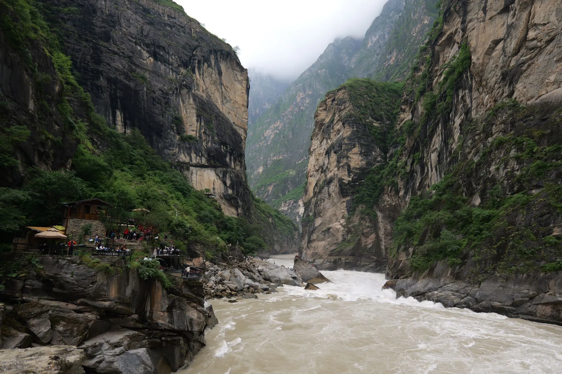 The Jinsha River (the upper Yangtze) forcing through Tiger Leaping Gorge.
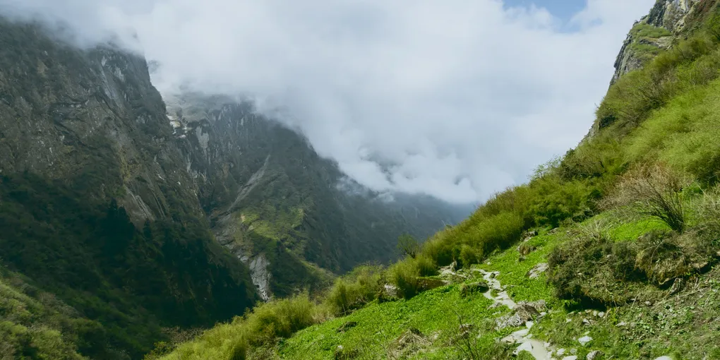
Tiger Leaping Gorge (虎跳峡) is where the Jinsha River (the upper Yangtze) forces its way between two of the world’s tallest mountains, Jade Dragon Snow Mountain and Haba Snow Mountain. The High Trail (高路) that runs along the canyon wall is the most famous hiking route in China among international walkers, and for good reason: it is physically demanding but technically easy, and the entire canyon experience is far from the tourist crowds of Lijiang, which sits at the gorge’s southern end.
| Fact | Detail |
|---|---|
| Length | ~23 km (14 mi) of high trail |
| Duration | 1–3 days; the classic two-day walk runs Qiaotou → 28 Bends → Halfway Guesthouse → Middle Tiger Leaping |
| Max altitude | ~2,670 m (8,760 ft) at the 28 Bends |
| Entry | Free on the trail itself; the developed Upper Tiger Leaping scenic area costs ¥45 ($6.60) |
| Best season | March–May and September–November |
| Permit needed | No |
| From Lijiang | Direct bus from Lijiang long-distance station, ~08:00/08:30 daily |
The 28 Bends are the hard part, a sustained switchback climb in the first morning, and above them the trail levels into a near-level ridge walk past Halfway Guesthouse, the classic stop for a room with a view over the gorge. Most walkers finish by dropping to Middle Tiger Leaping to see the famous Tiger Leaping Rock, then take a local minibus back to the road.
Local Tip: Book your guesthouse bed in advance on the popular half of the trail. Halfway fills with hikers every night in peak months, and there is no Plan B in the middle of the gorge.
Warning, read before you go: since 1 May 2026 the local authority has banned entry to the undeveloped sections of Middle and Lower Tiger Leaping Gorge on safety grounds, and railings have been added to some of the steepest descents. The High Trail itself and the main viewpoints remain open, but the route and its access rules change; check the latest official notice before you walk. China’s mountains and wild areas have been tightening access through 2025–2026; this is the pattern to expect everywhere.
2. Yubeng Village, Yunnan — three valleys under Kawa Karpo
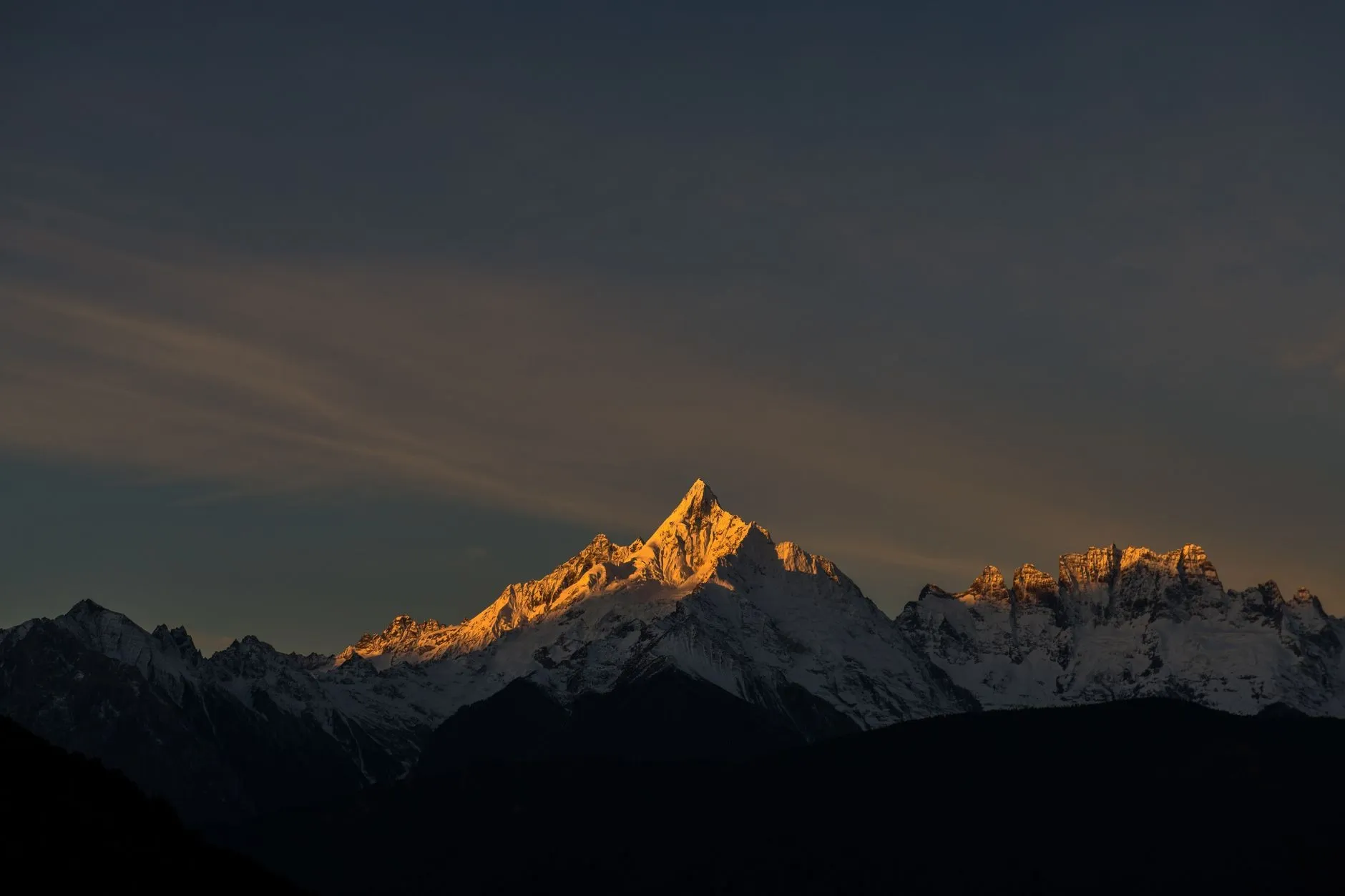 Kawa Karpo at sunrise, the sacred peak above Yubeng village.
Yubeng (雨崩) is a tiny village tucked beneath the sacred snow peaks of the Meili range, in the far northwest of Yunnan near the Tibetan border. It has become the archetypal “last village” hike: no road, no crowds of day-trippers, and a set of short, beautiful day loops radiating from two hamlets.
| Fact | Detail |
|---|---|
| Altitude | Upper Yubeng ~3,231 m; Lower Yubeng ~3,059 m |
| Best season | April–July; the villages sit under the snow line year-round |
| Getting there | From Xizang (西当), a ~12 km, ~6-hour hike up and over into the valley — or a local 4×4 when running |
| Park entry | Meili Snow Mountain National Park ticket, ~¥85 ($12.50) (2020 official “sincerity price”; verify current) |
| Permit needed | Border permit not generally required (Deqin is not a border county); confirm before you go |
The three classic loops from the village:
- Ice Lake (冰湖): ~14 km round trip, 6–8 hours, through forest to a frozen lake beneath the sacred peaks.
- Divine Waterfall (神瀑): 10–14 km, 4–7 hours, a pilgrimage route to a waterfall that is a holy site for Tibetan Buddhists.
- Ninong Gorge (尼农峡谷): the standard exit route, ~4–6 hours, following the river out of the valley, the way most hikers leave.
Local Tip: Start the Ice Lake day by 8am. The trail is exposed and the weather above the treeline moves fast. And note that since September 2025 the valley runs a shuttle-bus operation and private vehicles are no longer permitted to drive in; you hike the final leg regardless.
High-Altitude Commitments: Where Permits and Altitude Decide
These two are the real “trekking” of China, multi-day, high, and conditional on permits and guides. Do not attempt either as a first hike in the country.
3. Gongga Shan circuit, Sichuan — the King of Sichuan
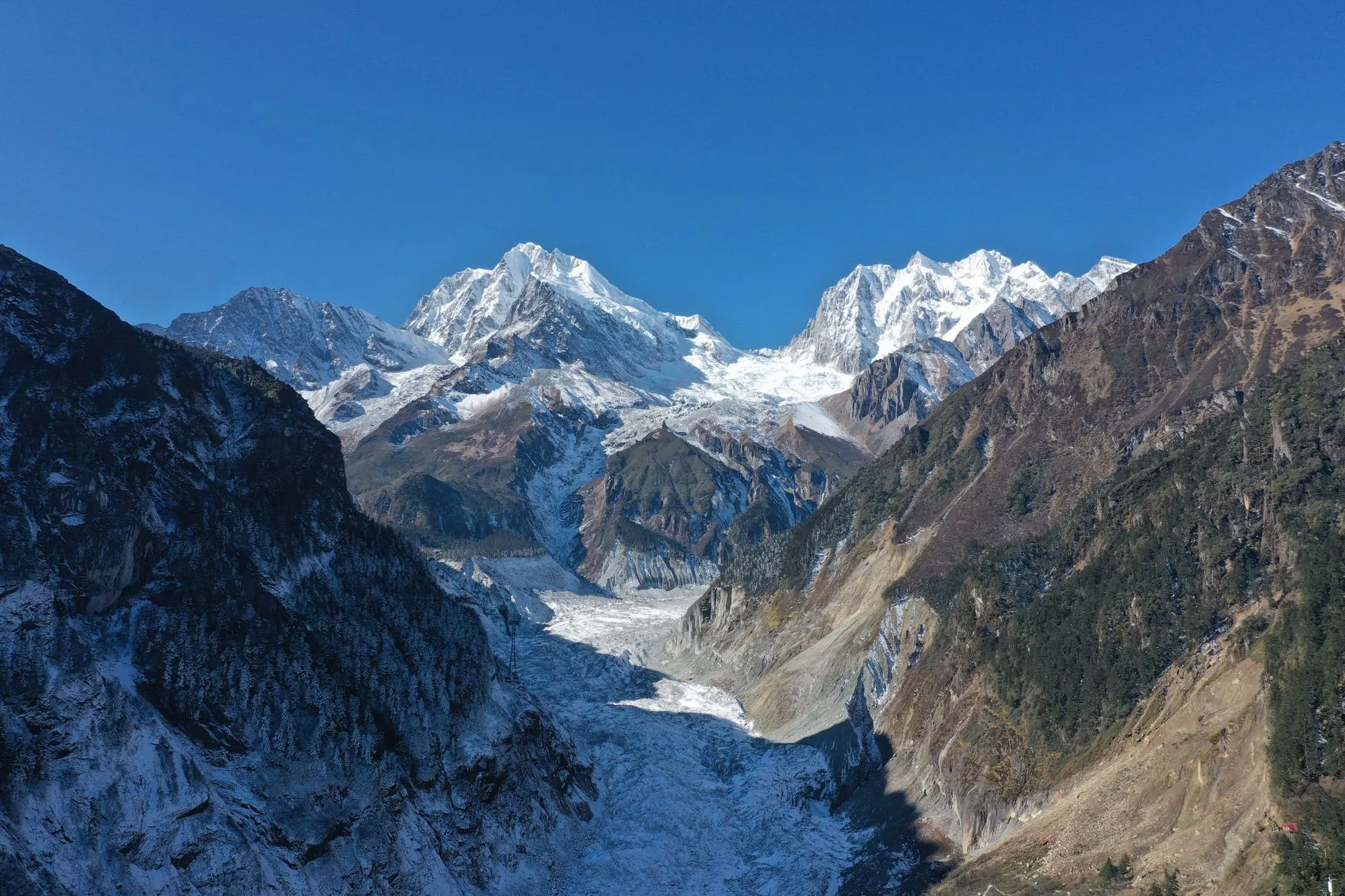 Gongga Shan, the 7,508 m “King of Sichuan” and its glacier valley.
Gongga Shan (贡嘎山) is the highest mountain in Sichuan at 7,508.9 m (measured 2023), and the circuit around it is the classic alpine trek of western Sichuan. The standard ring runs 70–80 km over 5–8 days, crossing passes at 4,920–4,980 m.
| Fact | Detail |
|---|---|
| Length | ~70–80 km (43–50 mi) circuit |
| Duration | 5–8 days |
| Highest pass | ~4,920–4,980 m (16,100–16,300 ft) |
| Best season | Mid-May to June (flowers) and September–October (autumn); avoid July–August rain |
| Border permit | Not required — Sichuan is not a border-management area |
| Climbing permit | Required only to summit peaks over 3,500 m, not to walk the circuit |
You can walk the Gongga circuit self-supported, but it is dangerous at altitude and there are documented cases of solo hikers going missing. The sensible approach is a guided group with horse support. Since 20 November 2025 the Kangding authorities have tightened management of undeveloped areas, and crossing protected zones requires prior approval; this is not a route to improvise.
Warning: the last high pass sits above 4,900 m. If you have never been above 4,000 m, do a day at 3,500–4,000 m first and read the altitude section below before committing.
4. Motuo, Tibet — the last roadless county
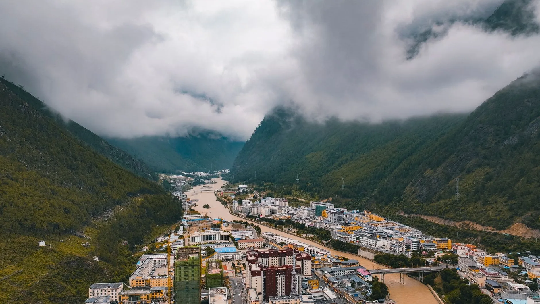 The Yarlung Tsangpo River winding through the gorge at Motuo county.
Motuo (墨脱), in southeastern Tibet, was the last county in China to be connected by road, and its historic name, the “Lotus Secret Land,” captures its reputation. The classic multi-day approach runs from Pai (派镇) over Duoxiongla Pass through Rag, Hanmi and Beibeng to Motuo itself, roughly 80 km over 3–4 days.
| Fact | Detail |
|---|---|
| Length | ~80 km (50 mi); classic section Hanmi → Beibeng ~38 km |
| Duration | 3–4 days |
| Leech season | June–October, worst July–September — gaiters are non-negotiable |
| Best season | May–June and September–November; avoid the July–August monsoon |
| Guide | Strongly required, especially for foreign visitors |
| Border permit | Required — Motuo is a border-management area since 1 March 2021; foreign visitors also need the Tibet Travel Permit |
Motuo is the hardest of the open trails in this guide: near-constant leeches in wet months, sections washed out by monsoon rain, and a demanding physical profile. The road to the county town opened in 2022 and now shortens some of the historic trail, so the “wilderness” experience is smaller than the legends suggest, but the leeches, the rain and the altitude are entirely real.
Local Tip: For Motuo and every Tibet border trail, you need the Tibet Travel Permit organised through a licensed Tibet travel agency before you fly or take the train to Lhasa. There is no way around it for foreign visitors. We explain the full paperwork in the permits section below.
Single-Day Scenic Hikes: Big Views Without the Expedition
Not everyone wants a multi-day trek. China’s five great scenic mountains, plus the Great Wall, offer satisfying hikes that fit into a day, with cable cars for the descent and, in several cases, spectacular sunrise walks.
5. Huashan, Shaanxi — the steepest of the Five Great Mountains
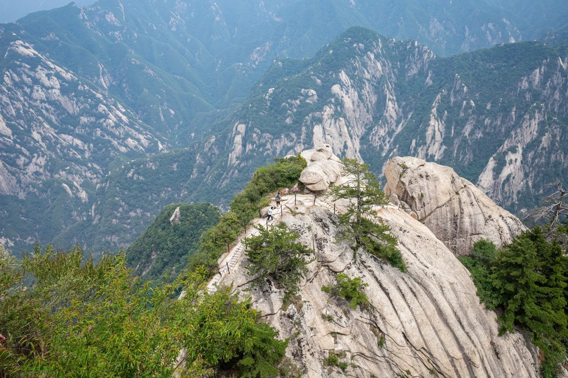 The cliff-hugging trail on Huashan, where holders and chains are the real handrails.
Huashan (华山) is the westernmost of China’s Five Great Mountains and the one that has terrified visitors for centuries. The classic full hike, Jade Spring Temple (玉泉院) to North Peak in about 4 hours, or all five peaks in about 8, takes you up the famous Changkong Plank Road (长空栈道), a cliff-hugging walkway bolted to a vertical rock face.
| Fact | Detail |
|---|---|
| Highest peak (South Peak) | 2,154.9 m (7,070 ft) |
| Tickets | ¥160 peak season (Mar–Nov) / ¥100 off-peak; cable cars and shuttle sold separately |
| Full hike | Jade Spring Temple → North Peak ~4 hrs; all five peaks ~8 hrs |
| Night hiking | The gate stays open 24h — the classic sunrise approach |
| Best season | April–May and September–October |
Most visitors ride the cable car up and walk the peaks, which is fine, but the full walk from the base is the real Huashan experience, and the night ascent to East Peak for sunrise is a Chinese travel institution. If you are packing a camera, read the drone rules for China before you go — registration applies even to small models. The Changkong Plank Road is optional and, for anyone afraid of heights, entirely skippable; the main ridge trails are dramatic but not life-threatening.
Local Tip: Do the night hike up, watch sunrise from East Peak (朝阳峰), then take the cable car down. It avoids the day-crowds and the midday heat, which are Huashan’s two real problems.
6. Wugongshan, Jiangxi — golden grass sea
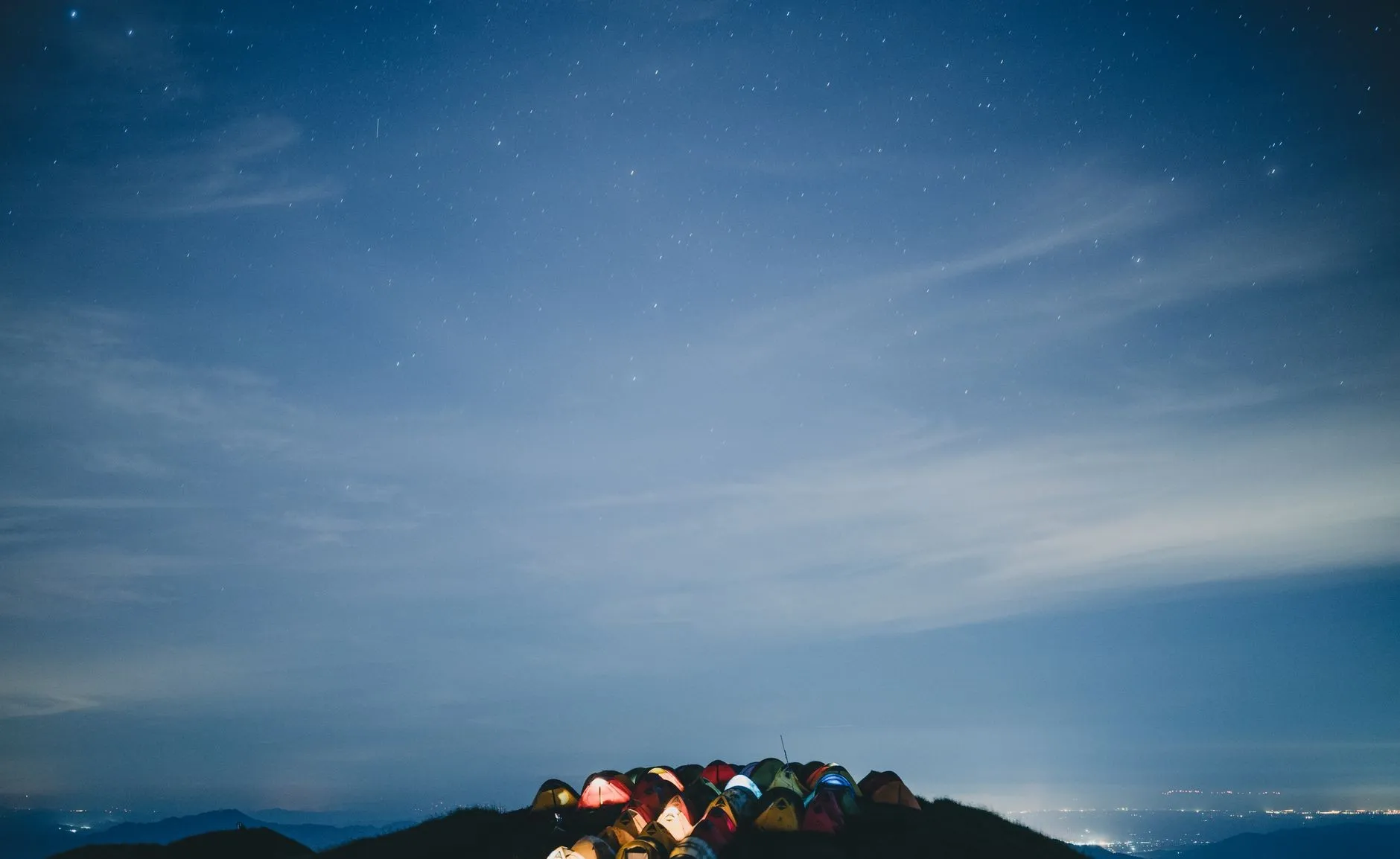 Tent camping on Wugongshan’s summit ridge under the stars.
Wugongshan (武功山), a 1,918 m plateau mountain in Jiangxi, is China’s most photogenic “grass sea” (草甸) hike, kilometres of rolling alpine meadow that turns a glowing gold in autumn. It is a gentle introduction to mountain hiking in China.
| Fact | Detail |
|---|---|
| Highest point | 1,918.3 m (6,290 ft) |
| Tickets | ¥70 ($10.30); cable cars sold separately |
| Typical route | 1–2 day traverse (e.g. via Shenzi Village or Longshan Village); or the safer 4-hour official path to the summit |
| Best season | May–June (green) and September–November (golden) |
The ridgeline traverse is lovely but, unlike the popular photos suggest, not a flat stroll; Baidu Baike warns that the crossing routes are complex and not for the absolute beginner. The safest option is the official summit path, about 4 hours each way, with the meadows and sunrise at the top. Camping on the summit ridge is a hugely popular summer activity.
7. Yading, Sichuan — sacred peaks and turquoise lakes
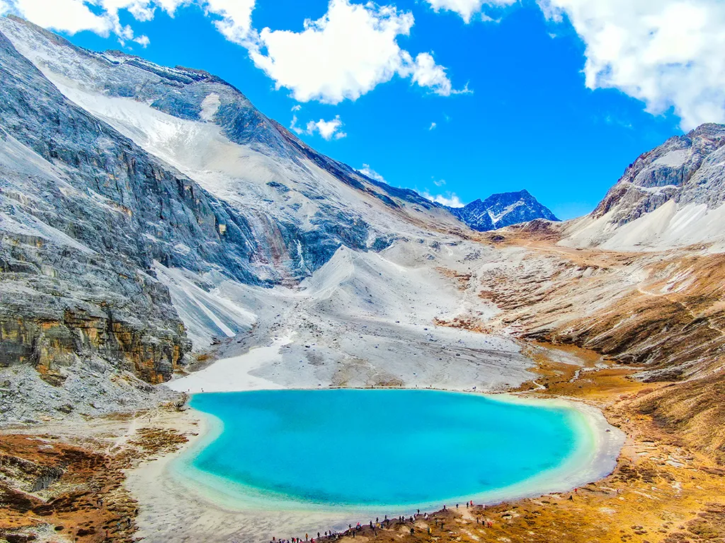 An alpine lake in the Yading Nature Reserve, the Shangri-La of travel-poster fame.
Yading Nature Reserve (稻城亚丁) in western Sichuan is the Shangri-La of travel-poster fame: three sacred peaks and a pair of alpine lakes reached by a high-altitude walk. It is a scenic-area hike rather than a wilderness trek, which makes it accessible, but the altitude makes it hard.
| Fact | Detail |
|---|---|
| Lake altitude | Milk Lake ~4,600 m; Five-Colour Lake ~4,700 m |
| The lake walk | ~3.7 km (2.3 mi) each way from Gongga Tso, 5–6 hours round trip |
| Tickets | ¥146 peak season / ¥120 off-peak; sightseeing bus historically ¥120 — the 2026 fare is in transition (a fee-free shuttle was trialled from May 2026), confirm on arrival |
| Best season | September–October |
The walk to Milk Lake and Five-Colour Lake climbs from about 4,300 m to 4,700 m, a short but brutal 400 m of altitude gain that has caused serious altitude sickness incidents, including fatalities in 2025 and 2026. No climbing permit is required, and you must stay on the official route; parts of the long loop have been closed after rockfalls. This is the one “easy-looking” hike on this list where people actually get hurt, so respect the altitude.
Note on prices: Yading’s ticketing is in a genuine transition period in 2026; a government promotion removed entry fees from 1 August to 31 October 2026, and the shuttle-bus fee was paused in May 2026 while fares are re-fixed. Treat any price from an old blog post as wrong and confirm at the entrance.
8. The classic scenic mountains (with dedicated guides)
Three more are worth listing because they sit inside China’s most famous scenic areas, each already covered in depth on this site:
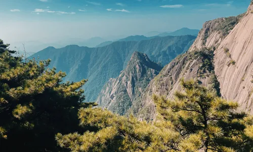
- Huangshan (Yellow Mountain), Anhui — the mist-shrouded granite peaks and wind-shaped pines. Walk the summit trails; the cable car saves the day’s climb. See our Huangshan travel guide.
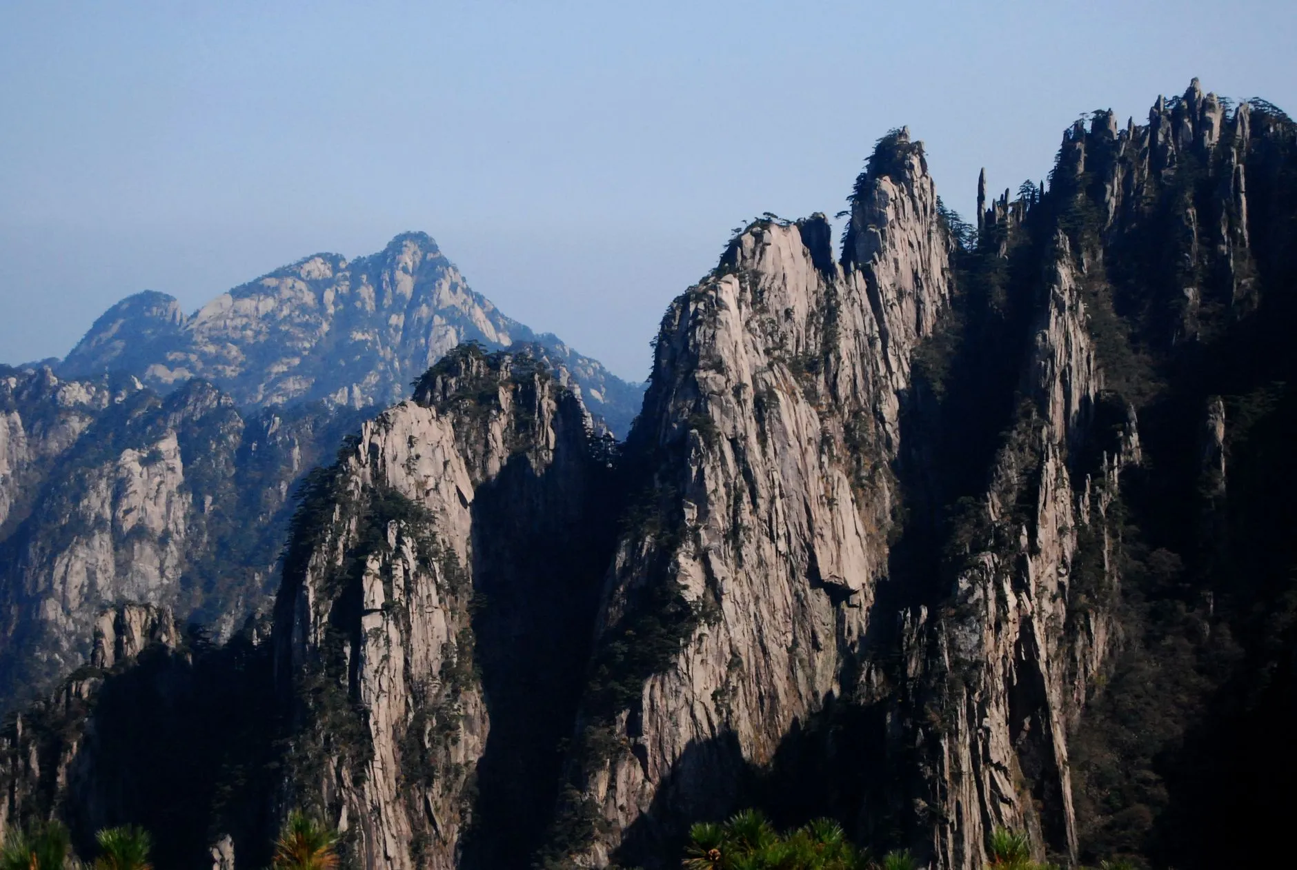 Huangshan’s granite peaks and pines, China’s most photographed mountain.
- Zhangjiajie, Hunan — the soaring quartz-sandstone pillars that inspired Avatar. Long boardwalks and a huge network of paths. See our Zhangjiajie travel guide.
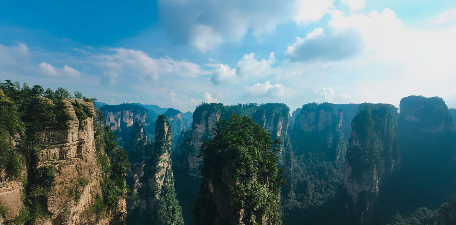 The quartz-sandstone pillars of Zhangjiajie, the real-world Avatar mountains.
- Emeishan, Sichuan — the sacred Buddhist mountain with a genuine multi-day ascent to the 3,099 m Golden Summit. See our Emeishan & Leshan guide.
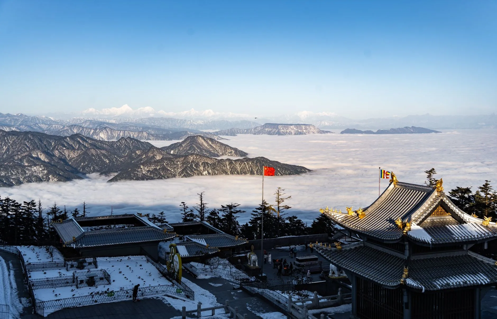 The Golden Summit of Emeishan in winter, temples, clouds and snow.
9. The Great Wall — the original China hike
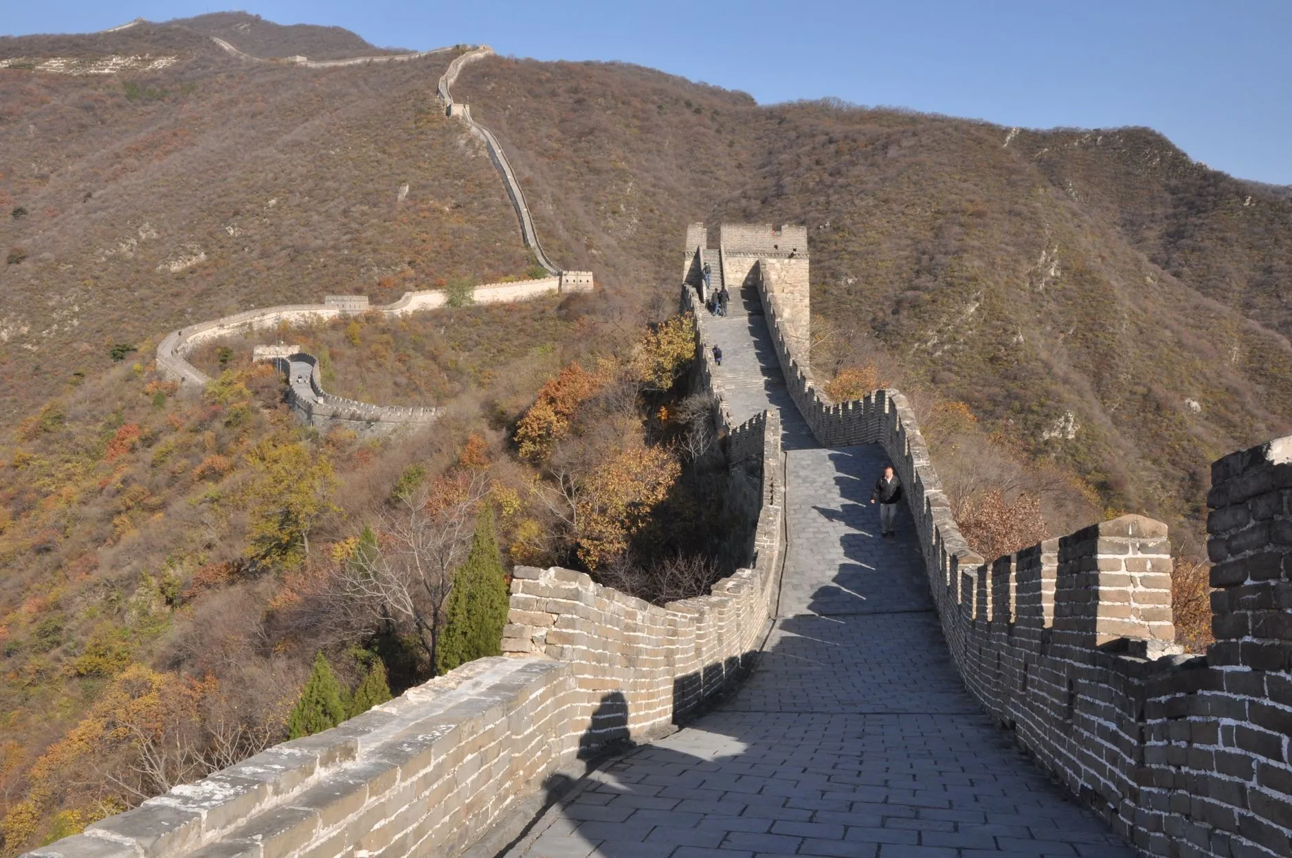 Hiking the Great Wall in autumn, the most walked trail in China.
Strictly, the Great Wall near Beijing is the most walked hiking trail in China, and it deserves its own treatment: five distinct sections, from the cable-car-and-crowds of Badaling to the wild, unmaintained towers of Jiankou. If hiking in China means a one-day walk for you, this is where to start. See our complete Great Wall hiking guide.
A legal note on “wild” Wall: Jiankou and other unopened sections are illegal to climb; the Regulations on the Protection of the Great Wall prohibit organised visits and climbing on stretches not open as scenic areas, with fines from ¥200 to ¥30,000 depending on the violation. The open sections (Badaling, Mutianyu, Jinshanling, Simatai) are where you should walk. Do not treat “free and no ticket” as an invitation.
The Legendary Routes Now Closed
This is the part most English guides miss, and the reason much older China-trekking content is now misleading. Two of the country’s most famous wilderness traverses are officially closed to trekking in 2026:
| Route | Status | What changed |
|---|---|---|
| Everest East Face / Kama Valley (珠峰东坡, Tibet) | Closed to trekking | From 12 March 2026, the official entry into the core and buffer zones of Everest National Nature Reserve for trekking is prohibited; the section is effectively closed indefinitely |
| Langta traverse (狼塔, Xinjiang) | Closed to crossing | Since April 2026 the Hutubi county authorities closed the Langta, Wusun and Xiata ancient trails to through-hiking |
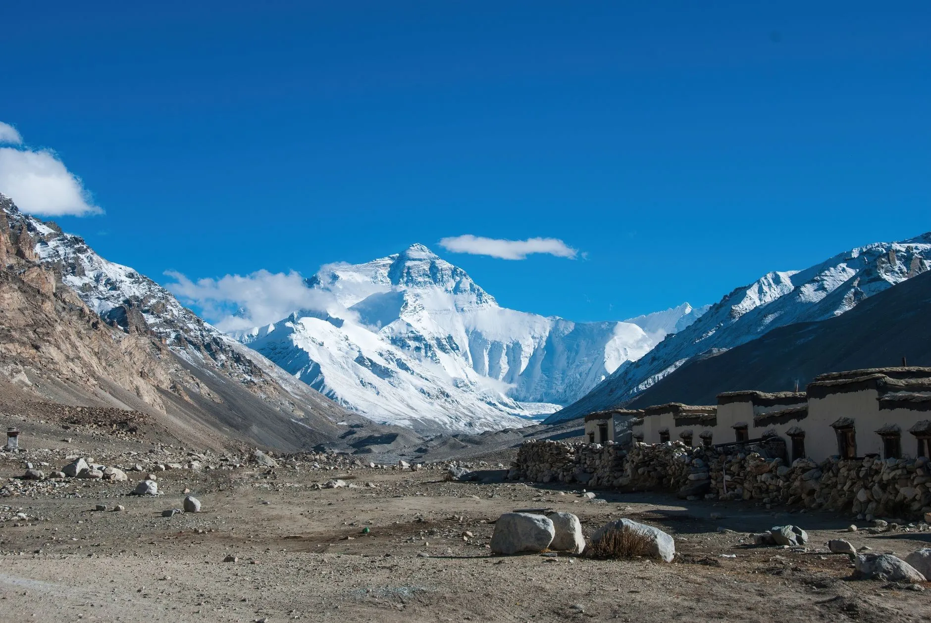 The Everest region, spectacular, and now legally closed to trekking.
The Everest East Face was long billed as the “world’s most beautiful valley,” with a 7–8 day, 70–80 km circuit passing the 8,000 m peaks of Everest, Lhotse and Makalu and crossing the ~5,300 m Langmala Pass. It was spectacular. It is now closed, and older itineraries still sell it, which is exactly why we are flagging it.
The Langta traverse was China’s hardest wilderness walk, a 120–130 km epic through the Tian Shan over 6–8 days with no support, no resupply and extreme difficulty. It is now under closure management, and any operator still listing it is selling something that does not legally run.
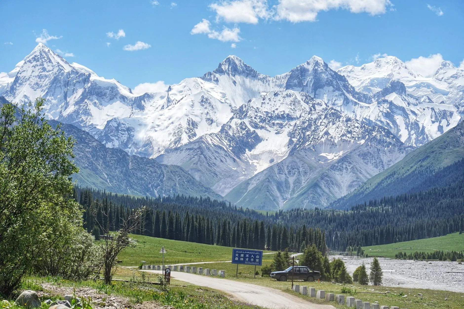 The Tian Shan, where the Langta traverse ran through. It is now closed.
Why this matters to you: if you are planning a 2026 or 2027 trip and a source (blog, forum, itinerary) still lists either of these as a bookable trail, that source is out of date. Chinese mountain and border access tightened sharply through 2025–2026, and the trend is toward more management, not less. Always confirm with an official source before you commit money.
Permits: The Three Layers Every Foreign Hiker Needs
China’s hiking permits are the single biggest gap between English advice and reality. For a foreign visitor there are three separate layers, and mixing them up is how people get turned around at a checkpoint or, worse, fined for an unpermitted ascent.
| Layer | What it is | Who needs it | When |
|---|---|---|---|
| Tibet Travel Permit (入藏函) | Required to enter Tibet at all | Every foreign visitor to Tibet | Organised via a licensed Tibet travel agency; foreign visitors cannot travel Tibet independently |
| Border permit (边防证) | Required to enter border-management areas | Foreign visitors heading to Motuo, Dingri/Everest region, Dingjie and similar border counties | Applied for in person with a valid passport; in Tibet usually arranged with the TTP |
| Mountaineering approval | Required to summit peaks over 3,500 m (other provinces) or 5,000 m (Tibet) | Foreign climbers, not hikers | Applied to the national sport authority well in advance |
The key distinction: walking a trail is not climbing a mountain. A normal trek on Gongga, Motuo, Yading or Tiger Leaping Gorge does not require mountaineering approval, but Tibet border trails (Motuo, and historically the Everest region) do require the Tibet Travel Permit + border permit double, and Sichuan’s Gongga needs neither border permit nor climbing approval for the circuit itself.
We cover the Tibet paperwork in full in our Tibet Travel Permit guide, including how to get it before you fly to Lhasa.
Warning: never enter a border or protected area without the correct paperwork. Fines for unpermitted mountain activity have been applied (a 2026 Sichuan case drew a ¥3,000 fine plus a ¥27,200 rescue bill), and a violation record can affect future visa applications. If a route is closed, it is closed; the fines and the safety risk are both real.
Altitude and Altitude Sickness
Three trails on this list sit in serious altitude territory: Gongga (up to ~5,000 m), Motuo (much of it above 3,000 m), and Yading (4,300–4,700 m on the lake walk). Altitude sickness is the most common serious medical problem on these hikes, and Yading has seen fatalities.
- Acclimatise before you climb. Spend a night at 3,000–3,500 m before a 4,000 m+ day. Do not fly straight to a high trailhead and start walking.
- Ascend slowly. The golden rule: gain no more than about 500 m of sleeping altitude per day once above 3,000 m.
- Know the symptoms. Headache, nausea, fatigue and dizziness mean stop and rest; worsening symptoms or breathlessness at rest mean descend. It is the only treatment.
- Oxygen and medication. Portable oxygen is sold everywhere in Tibet and Sichuan mountain towns. Ask your doctor about acetazolamide (Diamox) before you travel.
- Hydrate with salts, not just water, in the dry high-altitude air.
Local Tip: altitude sickness does not care how fit you are; the fittest hikers often get it worst because they push. A day or two of slow acclimatisation is the best insurance you can buy, and it costs you a hotel night, not a rescue.
Best Seasons for China Hiking
| Trail | Best months | Avoid |
|---|---|---|
| Tiger Leaping Gorge | Mar–May, Sep–Nov | Summer rain; winter is dry but greyer |
| Yubeng | Apr–Jul | Winter snow (avalanche risk) |
| Gongga | May–Jun, Sep–Oct | Jul–Aug monsoon |
| Motuo | May–Jun, Sep–Nov | Jul–Aug monsoon and leech peak |
| Huashan | Apr–May, Sep–Oct | Summer heat and crowds |
| Wugongshan | May–Jun, Sep–Nov | Summer storms |
| Yading | Sep–Oct | Jun–Aug rain; winter closures |
For the wider calendar across all of China, including the holiday rush that empties and fills the trails, see our best time to visit China master guide.
What to Pack for Hiking in China
Most of the trails here are day or short multi-day walks in mountain areas, so the kit list is lighter than expedition gear but heavier than a city pack.
Essentials:
- Grippy hiking boots (non-negotiable on Huashan, Tiger Leaping Gorge and the Wild Wall)
- Trekking poles — useful on the 28 Bends and the Yading descent
- 2 litres of water capacity, more in summer
- Layers: quick-dry base, fleece mid, windproof shell; it is cold at altitude even in summer
- Sun protection: SPF 50+, wide-brim hat, sunglasses — extreme UV above 3,000 m
- Rain gear: a lightweight poncho; mountain weather changes fast
- Headlamp for the Huashan night hike and Yubeng early starts
- Power bank and offline maps (the National Forestry and Grassland Administration’s maps or a downloaded map app)
Route-specific extras:
- Motuo: leech gaiters, and treat your boots and socks with insect repellent
- Yading / Gongga: portable oxygen, altitude awareness
- Anywhere remote: a basic first-aid kit and a printed copy of your route
Our complete China packing list covers the full-country version, including how to buy gear locally if you prefer to pack light.
Budget and Independent Travel
These hikes are inexpensive by world standards. Entry fees run ¥45–¥160 for the scenic mountains; the two medium classics (Tiger Leaping Gorge, Yubeng) cost well under ¥150 in gate fees for a multi-day trip. The expensive lines are the guided high-altitude ones: Motuo guides and the (now-closed) Everest region operators were the budget-killers, and any serious Gongga circuit with guide and horse support will cost a few hundred yuan per day.
For a full breakdown of what a hiking or multi-week China trip actually costs (trains, hostels, food, transport), see our China backpacking budget. For the do-it-yourself logistics (which China rewards more than most countries), our independent travel guide covers the practical mechanics.
Safety
- Respect closures and permits. A closed route is closed; a protected area without a permit is a fine and a rescue risk. This is not optional in 2026.
- Never hike high-altitude trails alone. The accidents on Gongga and Yading were solo, or people who pushed on. Go with a partner or a group.
- Acclimatise properly on anything above 3,000 m (see above).
- Start early (before 8am on the scenic mountains) to beat both heat and crowds.
- Check the weather at nmc.cn (National Meteorological Center) from about a week out, and take blue/yellow/orange/red rain and mountain warnings seriously. Flash floods in northern gullies are fast and lethal.
- Tell someone your route and expected return time; mobile signal is unreliable on most of these trails.
- Carry the essentials (water, layers, a power bank and a printed route).
- Register with your embassy if a trip is long or remote, and carry the 12308 consular-protection number for China.
- Leave no trace. These are protected landscapes; pack everything out.
Our broader China travel safety guide covers rescue, medical care and what to do if something goes wrong in the mountains.
Quick Selection Guide
| You want… | Go to… |
|---|---|
| The classic, crowd-free multi-day hike | Tiger Leaping Gorge |
| Village hiking with sacred mountain views | Yubeng |
| A serious alpine circuit | Gongga (with a guide) |
| The hardest open trail, leeches included | Motuo (with a guide and permits) |
| A dramatic single-day scramble | Huashan |
| Rolling meadow photography | Wugongshan |
| Turquoise lakes under 6,000 m peaks | Yading |
| A one-day walk with world heritage | The open Great Wall sections |
Prices, permits and closure status are accurate as of 2026-10-15 and change frequently, especially for border areas and wild mountain trails. Verify everything through official channels before you travel.
Sources & Verification
This guide was last verified on 2026-10-15. Key sources:
- Baidu Baike (百度百科): individual entries for Tiger Leaping Gorge, Yubeng, Motuo, Gongga Shan, Huashan, Wugongshan, Yading, and their sub-entries — the base for distances, altitudes, tickets and opening status.
- Mafengwo (马蜂窝): Chinese trekking guides cross-checking trail difficulty, season, transport and guide requirements.
- Regulations on the Protection of the Great Wall (长城保护条例) and Beijing Great Wall Protection Measures: the legal basis for why unopened wild-wall sections cannot be climbed.
- Administrative Measures on Mountaineering by Foreigners in China (外国人来华登山管理办法): the threshold at which walking a trail becomes “mountaineering” requiring approval.
- Entry-exit and border-management rules: the basis for the Tibet Travel Permit and border-permit layers for foreign visitors.
See our full verification methodology.
Related Articles
- Great Wall Hiking Guide (2026) — the open sections compared in detail
- Tibet Travel Permit Guide — the paperwork for Lhasa and every Tibet border trail
- Huangshan Travel Guide — China’s most famous scenic mountain
- Zhangjiajie Travel Guide — the Avatar mountains
- Emeishan & Leshan Guide — the sacred multi-day ascent
- China Packing List — the full gear checklist
- China Backpacking Budget — what a hiking trip costs
- Best Time to Visit China — the seasonal calendar
- China Travel Safety Tips — rescue, medical and mountain safety
- China Independent Travel Guide — self-organising a China trip
- Lijiang & Jade Dragon Snow Mountain — the base for Tiger Leaping Gorge
- Kanas Travel Guide — the far northwest’s great multi-day walking country
- Guilin & Yangshuo — river and karst hiking in the south